


Guru Maps 离线地图

Guru Maps 离线地图介绍
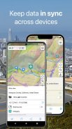
离线情况下照样可以去你想去的任何地方——离线矢量地图和离线搜索为你提供更好的旅行体验。记录你的 GPS 轨迹、为你最喜欢的位置添加书签并在不同设备之间进行同步。
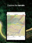
离线地图 (Offline Maps) :
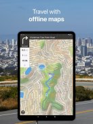
•无限制——对你所能够下载的国家/地区数没有任何限制
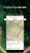
•详细、信息量大——因为它们是基于OpenStreetMap.org数据。
•最新的、精确的——我们每个月对它们进行更新。
•比其他应用程序占用更少的空间而且速度快——该应用程序同时使用多个 GPU 和 CPU 来渲染矢量地图。
•标签大小可变——开车时地图上更大的标签非常有用。
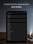
•多种语言支持——地图标签会即刻切换到所选语言。
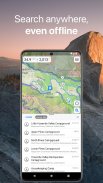
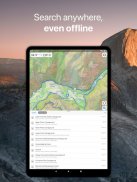
离线搜索 (Offline Search) :
•极快——你刚输入完结果就会立即出现。
•以多种方式工作——通过目标名称、种类甚至通过 GPS 坐标。
•以多种语言找到目标——这将使你的搜索比以往简单得多。
•无需网络连接。
地理数据同步:
•支持iCloud和Facebook和Google同步。
•可同时同步任意数量的设备。
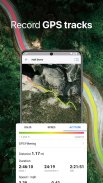
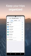
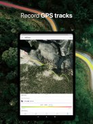
GPS 轨迹记录 :
•记录你的旅行并输出成KML/GPX文件。
•监控你旅行时的实时速度、距离、时间以及旅行期间在地图上的海拔高度。
•美观的梯度用来显示海拔和速度变化。
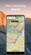
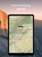
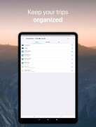
地图上的书签:
•在地图上标记你最喜欢的地方并设置你下次旅行感兴趣的地点。
•从许多图标中选择用来作为书签的图标。
•保存你的书签和 GPS 轨迹在各自的类别集合中以供快速存取。
分享你的地理数据:
•通过邮件、Facebook和Twitter分享你在应用程序中的旅游活动日程。
•以最常用的格式导出它们:KML & GPX & GeoJSON。
备份你的数据:
•备份你的类别集合从而获得可能会被意外丢失或删除的数据的副本。
•点击一下即可从你之前创建的备份中恢复数据到你的设备中。
•转移备份数据到另一台 iOS 设备或应用程序中
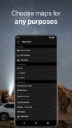
离线地图 (Offline Maps) 导入 [Pro]:
•以 .sqlitedb 或 .mbtiles 格式导入先前创建的自定义离线地图(使用Mobile Atlas Creator、TileMill或者SAS.Planet生成离线地图)。
来自thunderforest.com [Pro]:OpenCycleMap, Outdoors, Transport, Transport Dark, Landscape, Mobile Atlas, Neighbourhood.
更多:
•支持自定义地图来源(包括多层来源)
•不同的坐标格式(包括MGRS)
•导入KML/GPX文件到应用程序中
•GPS 过滤(精确度和距离阈值)
•书签基线
•单个手指缩放
•测量地图上两点之间的距离
您可以在设备上的 app 内购买额外的内容和订阅。
服務條款和隱私政策:https://gurumaps.app/terms_of_service.html
在后台连续运行 GPS 会急剧降低电池寿命。
Guru Maps 离线地图 - 版本5.8.1
(17-07-2025)
Guru Maps 离线地图 - APK信息
APK版本: 5.8.1程序包: com.bodunov.galileoGuru Maps 离线地图的最新版本
其他版本


同类应用

您可能还会喜欢……
 3.233.214.534.25


